 Recognised by govt.of Telangana
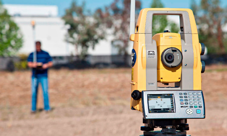
DGPS Training Hyderabad in India
DGPS Training
hyderabad
Syllabus: Survey is the first step for starting any civil work. Measuring the distances, angles, dimensions, and calculating the areas, volumes – Finding the different levels, slopes for executing the works of - Roads, Bridges, dams, lakes, culverts, canals, mines, Railway tracks, drainage system, water supply, oil pipelines, Farms, colonies, mark out for buildings etc; Preparing the survey drawing for presentation/ execution. We teach from the basics starting from Plain Table Survey, Chain Survey, Compass Survey, Contours, Levelling through Dumpy Level, Theodolite etc
Global Positioning System provides improved location accuracy, from the 15-meter nominal GPS accuracy to about 10 cm in case of the best implementations. DGPS uses a network of fixed, ground-based reference stations to broadcast the difference between the positions indicated by the GPS satellite systems and the known fixed positions. These stations broadcast the difference between the measured satellite pseudoranges and actual (internally computed) pseudoranges, and receiver stations may correct their pseudoranges by the same amount. The digital correction signal is typically broadcast locally over ground-based transmitters of shorter range. The term refers to a general technique of augmentation. The United States Coast Guard (USCG) and Canadian Coast Guard (CCG) each run such systems in the U.S. and Canada on the longwave radio frequencies between 285 kHz and 325 kHz near major waterways and harbors. The USCGs DGPS system has been named NDGPS (Nationwide DGPS) and is now jointly administered by the Coast Guard and the U.S. Department of Transportations Federal Highway Administration. It consists of broadcast sites located throughout the inland and coastal portions of the United States including Alaska, Hawaii and Puerto Rico. A similar system that transmits corrections from orbiting satellites instead of ground-based transmitters is called a Wide-Area DGPS
Global Positioning System provides improved location accuracy, from the 15-meter nominal GPS accuracy to about 10 cm in case of the best implementations. DGPS uses a network of fixed, ground-based reference stations to broadcast the difference between the positions indicated by the GPS satellite systems and the known fixed positions. These stations broadcast the difference between the measured satellite pseudoranges and actual (internally computed) pseudoranges, and receiver stations may correct their pseudoranges by the same amount. The digital correction signal is typically broadcast locally over ground-based transmitters of shorter range. The term refers to a general technique of augmentation. The United States Coast Guard (USCG) and Canadian Coast Guard (CCG) each run such systems in the U.S. and Canada on the longwave radio frequencies between 285 kHz and 325 kHz near major waterways and harbors. The USCGs DGPS system has been named NDGPS (Nationwide DGPS) and is now jointly administered by the Coast Guard and the U.S. Department of Transportations Federal Highway Administration. It consists of broadcast sites located throughout the inland and coastal portions of the United States including Alaska, Hawaii and Puerto Rico. A similar system that transmits corrections from orbiting satellites instead of ground-based transmitters is called a Wide-Area DGPS