
Our Misson
We are utilizing all our resources and are directing students towards enhancing, extending and modernizing the technical knowledge of the profession of surveying.
 Recognised by govt.of Telangana
At Geo Institute of Technologies, we are professional surveyors and are highly enthusiastic in bridging the gap between academics and the industry. After gaining 9 years of industry experience and knowing lack of skills in newcomers, we decided to lay the path by providing survey training to students irrespective of their past experiences or failures. We are known as one of the best Land Survey Training Institute in Hyderabad Telangana. Our work is result oriented with Live Projects and Hands on Equipment Training.
-"The illiterate of this century will not be those who cannot read and write, but those who cannot learn, unlearn, and relearn."!
We are utilizing all our resources and are directing students towards enhancing, extending and modernizing the technical knowledge of the profession of surveying.

Our Vision is to educate diverse learners and transforms communities by expanding the boundaries of knowledge and discovery.

This Institute is led by Enterprenuers, governed by a Board of Organization, and supported by numerous organizations.
As we are committed to help students in reaching their career goals, to personalizing their event experiences, to providing an innovative environment, and to making a difference. We offer distinct learning path. We have divided our course into two major modules i.e. Land Survey Training and Mapping Application Training.
Land surveying is the art and science of establishing or re-establishing corners, lines, boundaries, and monuments of real property (land), based upon recorded documents, historical evidence, and present standards of practice. Where this modules includes Land surveying, Hydrographic Surveying, Cadastral Surveying, Mine Surveying, Building and Quantity Surveying and Valuation Surveying.
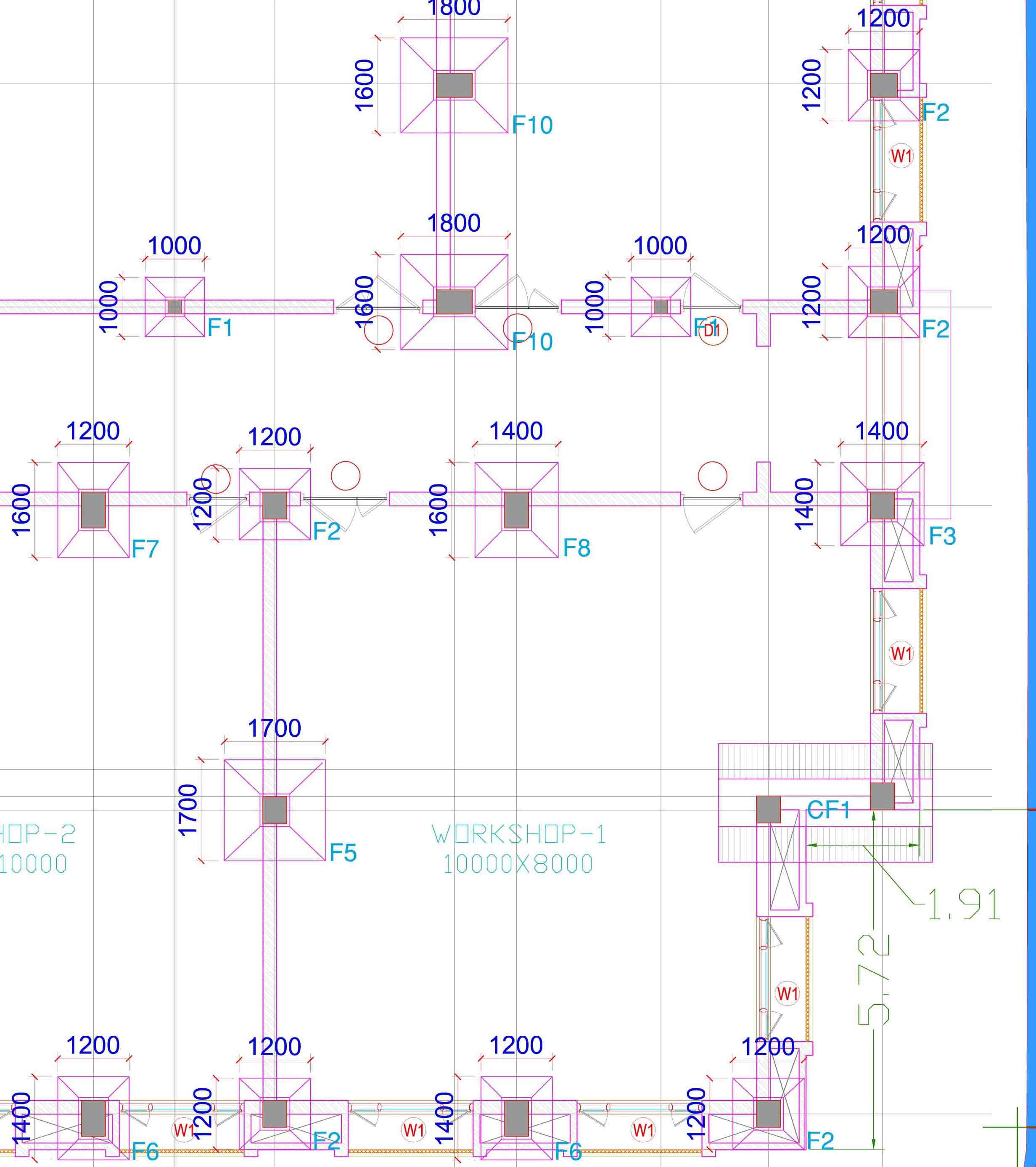
Mapping Applications are those in which all the designing of project occurs. This module includes learning of how data is transformed from surveying equipment to computer system. How to analyse, use, and calculate data using applications like Leica, AutoCAD, Civil 3D and more.

More than words, our values define who we are and how we operate.

We educate diverse learners & transform their careers.

We accelerate learning with focused, interactive & hands-on training.

Assessments gives confidence to students so they can respond to current organisational challenges.

We are team of professionals who train student as per industry trends with live projects.

We strive hard to place our students in right organizations and our focus is on both training & assisting for a better career.